
MAP OF ITALY
Map of Italy at scale 1:1.250.000 or scale 1:1.500.000 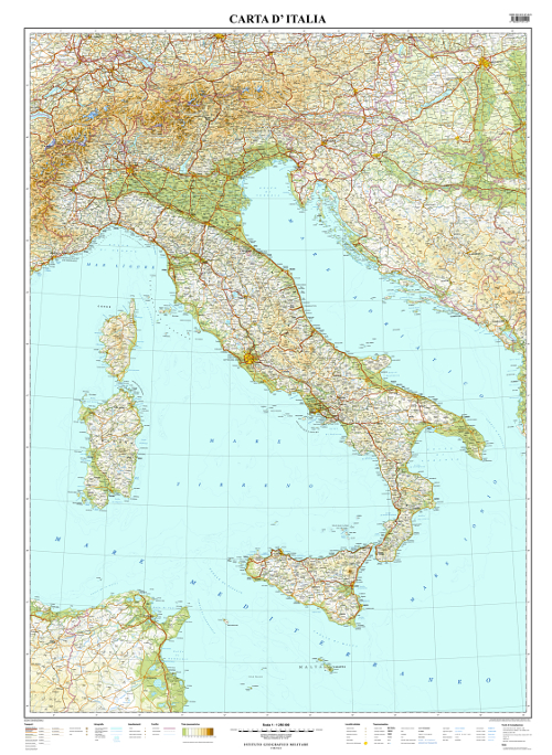 | |
|---|---|
|
|
|
|
| TYPE |
Geographic Map of Italy. |
| CHARACTERISTICS |
- Both natural elements and main human settlements are depicted in the general version. Main transports networks (roads, railways, ports, airports), as well as elements of hydrography (up to 4° IGMI order, main lakes and dams, glaciers) and human settlements (archaeological sites, historical and religious buildings) are indicated. Inhabited places are distinguished by population and administrative importance. State and Region boundaries are delineated. Relief is shown by hypsometric tints, shading and elevation spots. |
| SCALE | 1:1.250.000 or 1:1.500.000 |
| FORMAT |
|
| ELEMENTS OF THE SERIES |
The series consists of 1 sheets in 3 different versions; |
| END OF THE SERIES | scale 1:1.250.000 produced in 2013. Scale 1:1.500.000 produced in 2017 |
| TILE | Rectangular plan according to the projection adopted. |
| SPHEROID |
ETRS89 Geodetic Reference System. (GRS80 ellipsoid) |
| PROJECTION |
Lambert Conformal Conic Projection (Standard Parallels 38° 00' - 46° 00') |
| KILOMETRIC GRID | Not present |
