


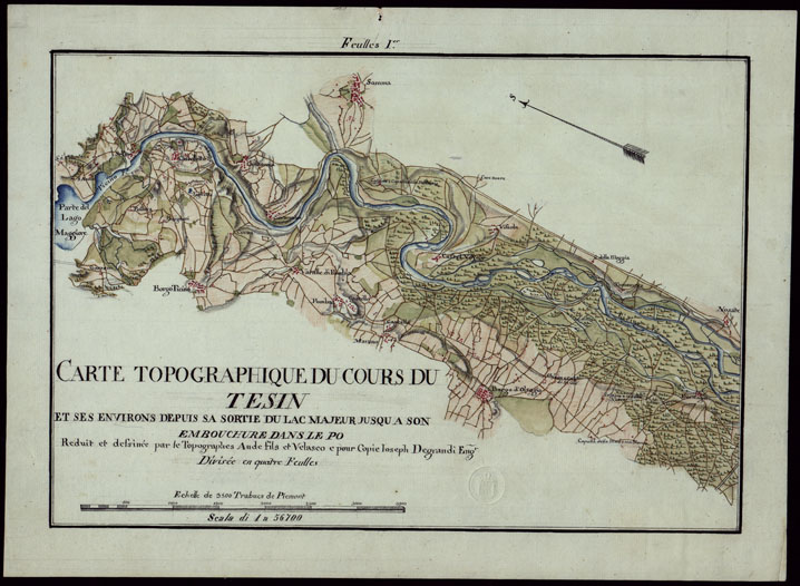
(N:23792) CARTE TOPOGRAPHIQUE DU COURS DE TESIN ET SES ENVIRONS DEPUIS SA SORTIE DU LAC MAJEUR JUSQU A SON EMBOUCHURE DANS LE PO REDUI ET DESSINEE PAR LE TOPOGRAPHES AUDE FILES ET VELASCO E POUR COPIE IOSEPH DEGRANDI ENG. DIVISEE EN QUATRE FEULLES - FEULLES I (CA002486) Carte e stampe antiche: riproduzione digitale a 150 DPI
Disegno ad acquerello a colori rosso (abitati), azzurro (acque), verde (vegetazioni). Al documento n. 245 altro esemplare in un sol foglio.
16.67€
NETTO
IVA
22.0%
-
Disponibilita'

- Accedi al sito per procedere con l'acquisto
Modalita':
Riproduzione digitale a 150 DPI
Data:
1800 (inizio)
Province:
Novara,Pavia
Comuni:
Borgo Ticino,Oleggio,Somma Lombardo

