


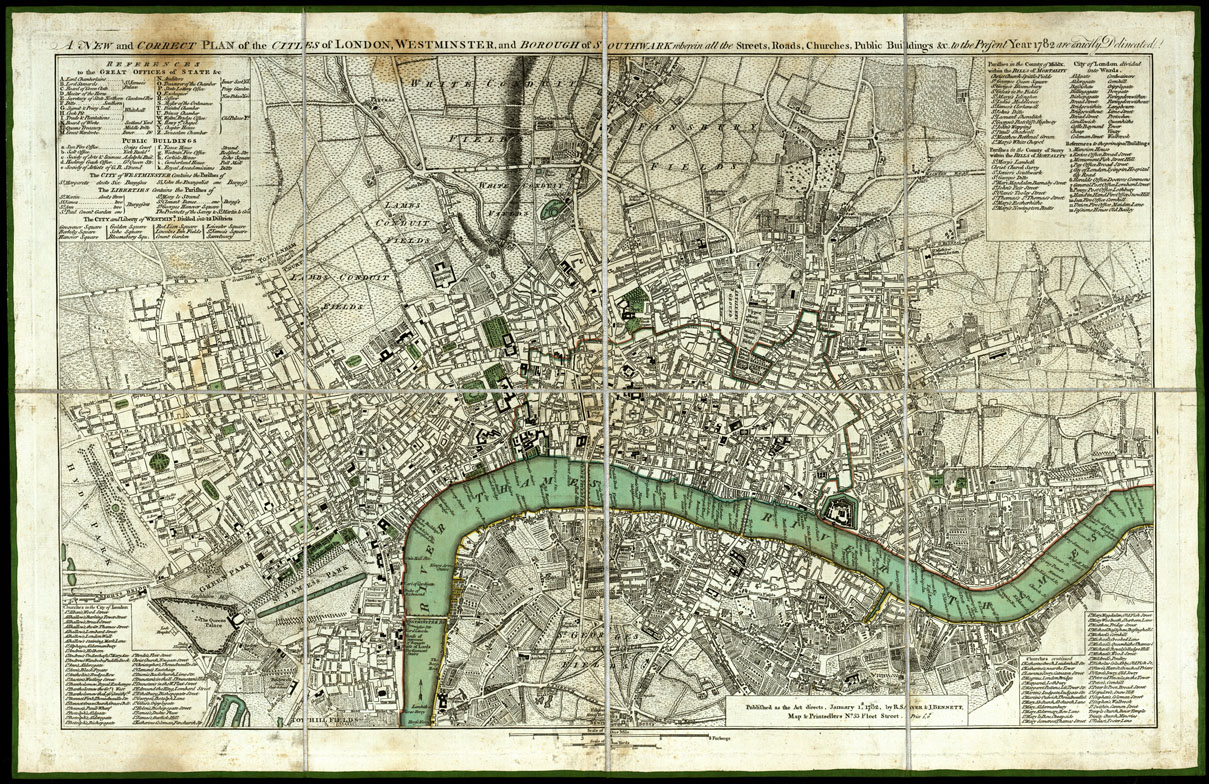
(N:20616) A NEW AND CORRECT PLAN OF THE CITLES OF LONDON (B0017074) Carte e stampe antiche: riproduzione digitale a 150 DPI
Westminster and borough og Southwark wherein all the Streets, Roads, Churches, Public Buildings, etc. to the present Year 1782 are exactly delineated. Published as the Act directs, January I, 1782, by R. Sayer and J. Bennet. Map and Printsellers n.53 Flect Strect. Price I S. Questo nuovo piano di Londra, di Westminster e dei borghi situati a sud, comprende tutte le vie rotabili, chiese, pubblici edifici esistenti nel 1782. Venne pubblicato dall'autore R. Sayer e Bennett. E' Inciso su rame in un foglio unico, montato su tela a stacchi, ed collocato in busta. Contiene scale grafiche, una in furlong, l'altra di Yards.
16.67€
NETTO
IVA
22.0%
-
Disponibilita'

- Accedi al sito per procedere con l'acquisto
Modalita':
Riproduzione digitale a 150 DPI
Data:
1782
Nazioni:
Gran Bretagna,Inghilterra

