


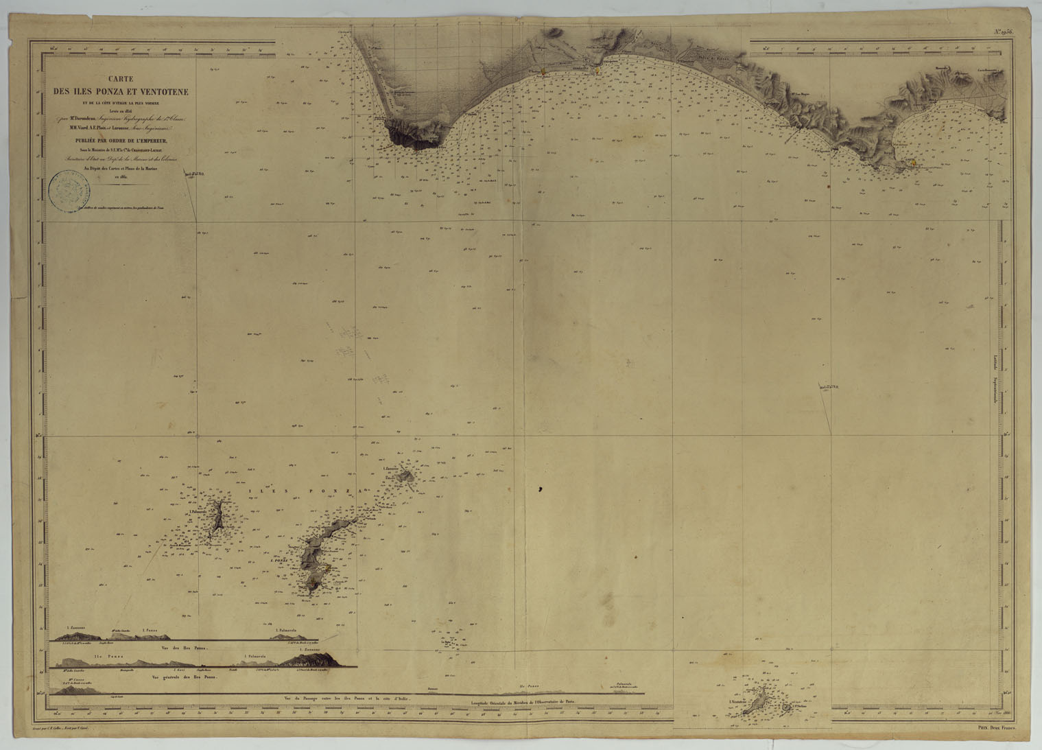
(N:10797) CARTE DES ILES PONZA ET VENTOTENE ET DE LA COTE D'ITALIE LA PLUS VOISINE LEVEE EN 1856 PAR M.R DARONDEAU INGEGNIEUR HYDROGRAPHE DE 1ER CLASSE M. M. VIARD, A. E. PLOIX ET LAROUSSE, SOUS-INGEGNIEUR. PUBLIEE PAR ORDRE DE L'EMPEREUR (CA007520) Carte e stampe antiche: riproduzione a colori su carta (formato A1)
SOUS LE MINISTERE DE S. E. LE C.TE CHASSELOUP-LAUBAT, SECRETAIRE D'ETAT AU DEPT. DE LA MARINE ET DES COLONIES AU DEPOT DES CARTES ET PLANS DE LA MARINE EN 1862.
Un foglio tratto da incisione in rame, pubblicato nel 1866. Incisore C. E. Collin. Scritture di V. Carr. L'orografia lungo le coste rappresentata col tratteggio. Gli scandagli sono calcolati in metri. In basso a sinistra tre vedute.
30.0€
NETTO
IVA
22.0%
-
Disponibilita'

- Accedi al sito per procedere con l'acquisto
Modalita':
Riproduzione cartacea a colori A1
Data:
1866
Province:
Latina
Comuni:
Gaeta,Ponza,Sperlonga,Terracina,Ventotene

